Sunday 18 January 2015

Leg Four : Cape Wrath Trail - 2014 [Braemore Junction to Inchnadamph]

It was becoming a ritual now, and with further inspiration received from blipper Ian Somerville, I spent the remainder of 2013 planning the next leg of the route. It was becoming a pleasurable evening distraction; how to use public transport to get back to the car? Were there any Corbetts en route? Are there going to be river crossings to negotiate? Once I had settled on a vague route, I relied on the excellent Geograph site which plots ground level images of almost every OS 1:50K grid square in the UK. This was helpful in determining river widths, ground vegetation and such like in order to 'plan' the route in finer detail. Some might say this is not in the spirit of exploration, but I was not bothered. It gave me some solace to know that other humans had actually been where I wanted to tread. There might not be dragons afterall!

19th April 2014
Distance : 27.7km
Ascent : 1800m
Time : 9hours


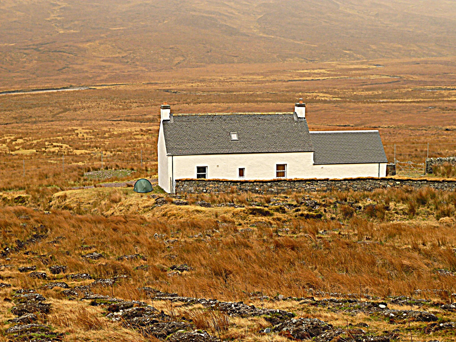
Once again, I had travelled north on the day before, but this time had made use of the fantastic weather by ascending Sail Mhor above Dundonnell, waving at the goats on the way. I camped in Ullapool and in the following sunny morning, left the car outside the eclectic Ceilidh Place.  

I stood at the bus stop at the ferry ticket office in the morning sun. Rucksack stressed at the seams, walking poles in place, buff round my neck and sunglasses on. After a few minutes, an old local bufty walked up to me. "Ye ken the ticket office is closed?" he said
"Sorry?"
"The ticket office," he gestured behind me at the ferry terminal, "its closed for refurbishment."
"Oh no, I'm waiting for the bus to Braemore," said I in my broadest accent. 
"Ah right, I thocht ye were a tourist for the ferry!"

The bus hissed into the parking area, and as I checked with the bus driver where I wanted to go and the fare, he waved his hand and said "Doesna matter pal, on ye get". 

We pelted along the A832 towards Inverlael, taking bends faster than I would in my car, and soon I was alighting at Braemore, after my gratis journey. 

Twelve months before at the same spot as I finished , I was wet, cold, miserable, and the bus was late. Today, it was a lovely warm morning, and I was raring to go....

The first section of this walk would be onto the hills pretty much from the start, but I wanted to keep my feet dry and hoped that the vehicle track on the map leading towards the Home Loch would be my salvation. It wasn't to be. The tracl was barred by a gate which held a sign with strict instructions for walkers trying to get to the Home Loch to go via the hill path, and not the vehicle track. Tail between my legs, I turned round, walked across the parking area to the edge of the forest and stepped onto the hill. 

The path itself wasn't too bad, but in wet weather it could have been a quagmire. I made good progress to the Home Loch which was perched above Inverlael, a wonderful backdrop. I joined with a vehicle track briefly and passed through a herd of weird looking sheep/goats. Or shoats.

The Home Loch with the Fannichs behind

Shoats


At a junction, I left the track and ventured into the young bracken, following another good stalker's path up to the 550m col between Beinn Enaglair and Meall Doire Faid. Near to the high point, I passed an enormous boulder lying in a bog. It was house sized. Maybe. 

What little wind there was had dropped, and I was now sweating like a sweaty person. I decided to change into shorts which I had optimisticlly brought and ended up wearing for the next two days! After some food, I left the path and climbed the 300m to the summit of Beinn Enaglair, the first of many summits for the day. The views were incredible, and I spent some time surveying where I had come from in 2013, to where I was heading. 

I had Radio Scotland in my ears again, this time it was John Beattie's sports programme and Denis Taylor was musing about the coming hopefuls at the Crucible. Leaving Beinn Enaglair was trickier said than done, and I found myself contouring for a few metres to avoid some crags and scree. 

Next was the wonderfully named Iorguill (872m) which I managed to ascend easily after picking up an excellent stalker's path that zigzagged me up to the summit. Whilst grabbing a bit of food to eat, John Beattie switched to Stuart Cosgrove - time for a podcast on the ipod - an episode of the Infinite Monkey Cage led me on to the summit of Beinn Dearg (1084m) via the massive Mourne like wall that bounds the south side of Gleann na Sguaib. The summit itself is on top of a dome away from the wall (and my route north), but it had to be climbed.

Gleann na Sguaib wall


Back to the wall, I slithered through the old spring snow down to the tri-col, passing a large group of walkers on the way up. Then over to Meall nan Ceapraichean (977m) for lunch. I had travelled some distance by now, but was tired from the amount of ascent carrying the pack. There was still one more Munro to cross. 

More snowfields to skite down into the next col and ahead I spied a pair of walkers moving slowly up to Eididh nan Clach Geala (928m). I caught them at the summit and chatted for a while. It was their final summit for the day, and were heading back to Inverlael next. When asked where I was heading, I soon realised how far I had to go. It was a daunting prospect. Who planned this route?? 

Thankfully the weather was perfect, and underfoot it was dry and made for easy walking. I dropped down to Coire an Lochain Sgeirich to refill the water bottle at the same time as another pair of walkers who were returning from Seana Bhraigh. The thought that they were heading somewhere known, probably a comfortable bed knocked me a bit, and the next section of knee high heather didn't help matters. 

I reached Gleann a Chadha Dheirg and the wide River Douchary emanating from the coire below Seana Bhraigh. This was remote. You had to work hard to be here. But at least I was heading almost due north, eating up the kilometres. 

River Douchary


On the map, there was a vehicle track marked heading a long way up the glen. But the internet and Google Earth had told me otherwise. Now I could see it for myself; the track did not exist, but started a few kilometres across the hillside to the north. No matter, I had been off track for most of the day so carried on north. When I did eventually reach the track, it was no help, just a gravelly muddy mass instead of dry heather. 

But after another kilometre it had established itself into a more hard packed gravel and I was on my way. To my right, below the cliffs of Meall nam Bradhan, I watched an eagle soaring along the hillside, tracking a lone deer that was running to somewhere. It was fascinating to see however I was now officially nackered. I sat on my rucksack at the side of the track eating peanuts and chocolate and sipping water. I looked at the map. Ideally I wanted to reach Duag Bridge at day's end, but it was still 10km away. Even though it was 5pm, and there would still be 2hours of light, I didn't feel like I had the energy. 

I plodded onwards, finding some FM radio reception near the path junction with Strathmulzie and listened to Dermot O'Leary briefly before he disappeared into a maelstrom of white noise. Once again to my right, a wonderful view unfolded with the dark depths of Coire Mor and the Alp-like Creag an Duine towering majestically into evening light. I had climbed its steep narrow ridge in November 2011 and still remember it to be the best mainland mountain ridge scramble I've experienced. 

At last I reached the main track in Strathmulzie beside a side tributary. I decided to call it a day. 

My campsite in Strath Mulzie


20th April 2014
Distance : 30km
Ascent : 150m
Time : 8.5hours


The tent flysheet had frost on it when I woke up as the sun rose above the horizon over Cnoc an Tubait. Brrrr! It had been a cold night, but I had slept well after my marathon the day before. Whilst I breakfasted, I tried to get the sun to melt and then evaporate the moisture on the flysheet; its not good to be carrying a wet tent. 

Today was going to be an easy walk compared to yesterday, no worry about navigation or river crossings (ahem - wait till later), little or no ascent. Infact, pretty dull. the earphones went in, with an audio book recently downloaded from the Edinburgh Libraries catalogue - Laidlaw by William Mcilvanney. 

Strathmulzie, 20th April 2014


The bothy at Duag Bridge was empty. The visitors' book had no entry for days, if I'd had the energy to reach it last night I would have been alone. After some cheese and biscuits, and watching a female walker's car roll past the white curtained window, I plodded on down the track towards Oykel Bridge. The day was warming up to be a scorcher and I put on some suncream when I reached the bridge. 

Butterflies flitted between dandelions and primroses on the bridge as I used the mobile reception to text home and update my progress.  I took a break from Laidlaw and listened to Michael Portillo pontificating about the build-up to the first World War.  

Oykel Bridge


When planning this section of the route, I had reluctantly conformed to follow the track all the way to Oykel Bridge, but on the map this meant heading east, rather than north. Over the winter I had spent a long time studying Geograph pictures of the ground north of the river. There was a bridge over the River Einig near Craggan, and some forestry to negotiate over the hill to reach Lubcroy, but my only hesitation was about accessing the bridge marked on the map at 352027 to cross the River Oykel. 

Following the well maintained vehicle track along the north side of the Strath, I was dismayed to see that the footbridge at 352027 was in working condition; I could have come over the hill afterall. Nevermind. 

The sun was scorching now, and there was no shelter for several kilometres. Near the fateful footbridge, I passed through a cattle farm, with a loud herd of cows swatting flies with their tails. Nearby I stopped in the shade of a shed for some food, and noticing my mobile had 5bars of reception, made a phone call home. It was this break, I am sure, that resulted in a handful of new ticks on my legs. 

Eventually I entered the forestry, and reached the marked fishing beats of the Oykel. I stopped at the fisherman's lodge named Salachy on the map to eat lunch in the wooden hut. It was like a sauna inside, but I was glad to get out of the sun. I lay my damp thermal top on the picnic bench to dry. 

Another four kilometres brought me to the tarmac leading to Ben More lodge at the other side of Loch Ailsh. What a view! The waters of the loch were still, only broken by the odd duck. I could hear bird song from the far side. The lodge stood majestically with the backdrop of Ben More Assynt towering behind. 

Loch Ailsh and Ben More lodge


It was mid-afternoon as I reached the small hamlet of houses near the lodge, working dogs barking from their kennels, poultry pecking grass. Kids' clothes drying on a washing line, Argo cats and quad bikes parked up. Didn't see a soul though!

My day was coming to an end, and William Mcilvanney was also drawing to a close - a cracking listen. I followed the River Oykel and crossed the tributary of Allt Sail an Ruathair looking out for the bridge marked to the east of Black Rock. Disconcertingly, the map wasn't shown on the 1:25K map, only the 1:50K. The bridge didn't exist. 

Boots and socks off, I waded across to the grassy west bank and found somewhere for the tent. 

Camp below Ben More Assynt


21st April 2014
Distance : 14.2km
Ascent : 760m
Time : 5.5hours


Whilst packing the tent up, the stronger wind set the scene for the day and I struggled to control everything as I stuffed it into various containers. Behind my campsite was the ominously named Black Rock. Two hundred metres of weird orangey black rock led me upwards into the low cloud. A little bit of map reading and I was heading for the Bealach Choinnich, disturbing a large herd of deer in the process who scampered off into the cloud. Higher and higher I climbed, onto the gnarled quartzite screes of Breabag. 

A vague path through the screes led me to the edge of Coirean Ban where I was afforded a wonderful view across the glen to Conival and Ben More Assynt. I found the summit cairn in a gale, and ate a Snickers bar behind a rock. It was Monday morning so I found Ken Bruce blethering away in my ears on Radio Two. Unfortunately the wind was so strong, that even on full volume, I struggled to hear the Pop Master quiz questions. 

Coirean Ban

Suilven from Breabag


The Corbett of Breabag (815m) is a bit like Beinn Eighe, in that its not your average single topped mountain, its more of a mountain range in itself. I had to navigate the wide rocky ridge in a vaguely NNE direction, struggling against the wind buffeting me off the mountain. On a numer of occasions I had my hands on rock; to ascend a curious barring cliff; to pad up a slab; to catch my balance at the top of the next cliff.

Breabag complexity


This is a complex mountain!

Eventually, I reached a point where it was safe to descend north towards the Munro baggers' path to Conival. I reached this after twelve and had a pleasant stroll alongide the elusive River Traligill towards Inchnadamph. On the way I passed a few walkers heading for the Munros and I warned them of the wind I had experienced at higher altitudes. 

Heading towards Inchnadamph


A kilometre short of Inchnadamph, I stopped for lunch whilst listening to John Beattie extolling the virtues of city cycling. Then it was on to the road and the anxious wait for the only bus of the day back to Ullapool. It arrived 20minutes late (nothing like a CWT tradition!) and I was soon on my way back home down the A9. 

This leg had been the most satisfying of the four so far, probably because of the weather I had experienced. But the hills of the first day were second to none, and both campsites were good. No hotels this time!


Tuesday 13 January 2015

Leg Three : Cape Wrath Trail - 2013 [Strathcarron to Braemore Junction]

I had enjoyed my previous leg (2011) so much that I had to continue. The logistical transport challenge added to the months of planning made for a satisfying timewaster over the winter months of 2012/13 and in April I was ready.

20th April 2013
Distance : 32km
Ascent : 1142m
Time : 8hours


On the evening before, I had driven up to Inverness and stayed at the soulless Fairways Travelodge. An early start and I drove to Garve where I parked the car near the railway station. The weather was overcast, with a little light rain as I waited for the train towards Kyle. Eventually it rolled into sight and I was on my way west to Strathcarron.

Alighting at Strathcarron, I was all ready to set off and was along the road before the train had disappeared along the coast. After a few hundred metres of tarmac I left the road and followed the wide River Carron as it meandered through the fields to the east of New Kelso farm. Too soon I reached the road again and nipped along to leave it at Coulags. Here was where the wilderness began.

Coire Fionnaraich bothy

I made rapid progress up the stalkers' path to the Coire Fionnaraich bothy. No-one was at home so I took the opportunity for a seat and a snack. The weather wasn't improving much, fairly breezy with moisture in the air, but not raining as such. I continued onwards past the massive mossy Clach nan Con-fionn and then round the lonely loch at the head of the glen. Two paths converge here, and I passed two females who had crossed the Bealach na Lice from the west. I went east at the junction and climbed higher to the Bealach Ban and into the mouth of Coire Grannda. I passed some impressive slabs of Torridonian sandstone whilst looking north to the same mountains. Unfortunately they were shrouded in cloud but the wind was strong enough to press me on my way. I briefly had a contact lens mishap in the wind and had to perform some fiddling to regain my sight.

The frozen Lochan Uaines below the Corbett Sgorr nan Lochan Uaine


I contoured round the side of Sail Gharbh and then ascended towards a series of three small lochans, named Uaine, but actually white and partially frozen today. The wind was growing in strength and I ascended the Corbett of Sgorr nan Lochan Uaine with trepidation. The summit was wild, and the tiny cairn offered no shelter. I needed some food so quickly stuffed some chocolate in my mouth before descending due north out of the wind and into the complexity of this wild land. Although I was carrying a 1:50K map, even the detail of a 1:25K map is not sufficient to define this area of ground. I found myself backtracking on several occasions to negotiate wee unmarked crags and lochans and at this stage of the day found it quite frustrating.

Looking back to Sgorr nan Lochan Uaine - some very complex terrain here

I found a grassy rake to follow across the face of a steep cliff which led to the path up to my next Corbett, Sgurr Dubh. After dumping my rucksack (and memorising its location!), I ascended the 200m up to the rocky summit. The wind was mental now, and a squall of sleet came through as I battled to reach the summit. The shattered quartzite was lethal when wet and I did well to not be blown over.

Returning to the 'sack, I was relieved to be back on some sort of footpath again, and not have to woory too much about navigation. The path led me down into the gnarled forest beside the Allt na Luib and the settlement at Coulin. It was probably around 5.30pm now and I was thinking about stopping for the night, but there weren't many obvious sites to pitch that wouldn't impact the natives.  Three working dogs (lab, and two terriers) came racing up the track from the keepers house. Simultaneously barking & wagging, I kept them at walking pole's distance just in case.

The road to Kinlochewe


I reached the tarmac of the estate road, and plodded onwards to the Glen Torridon road. I knew from past visits there'd be no suitable wild camp spots within easy reach of fresh water / away from the road. So made the decision to try Kinlochewe Hotel. After a phone call to check availability (and most importantly when they would stop serving food!), I upped the pace and reached the village in an hour.

--------------------------------------------------------------------------------------------------

21st April 2013
Distance : 20km
Ascent : 600m
Time : 6hours


The sleep of the dead. After a hearty breakfast, I left the village and followed the tarmac and then track to the Heights of Kinlochewe. The weather was warmer, with even some blue sky in patches. The Abhainn Bruachaig to my right was an impressive river emanating from the hills ahead. In my ears, I listened to a recorded 6Music radio programme from Marc Riley the week before. Some fantastic tunes.

Beinn Eighe with Abhainn Bruachaig in foreground
 I turned left at the fork short of the Heights and passed through a deer fence gate before climbing round the hill into Gleann na Muice. As I crossed the bridge to the north bank, the weather took a turn for the worse and the heavens opened. Soon enough I was at the point to leave the track and return to footpath. The junction was marked with this incorrect Scotways sign below. At least if was a good time to get the waterproofs on and eat some food.

Get the map out here to doublecheck!
The path was elusive, and after a kilometre or so I had lost it in the marsh. Undeterred, I squelched on into Gleann Tanagaidh and crossed the wide river with only a couple of boot immersions. I was now in the edge of Coire Mhic Fhearchair, that wild and lonely corrie spied on our round of the Fisherfield Six in 2011. I felt lonely too now, and with no paths, wind turbines, forests, or any signs of habitation in sight, it did feel remote. My wet feet didn't help. I climbed up to the Bealach Gorm and dropped down into the final glen for the day. On the way I picked up a few long roots of bogwood, and also came across a sodden fleece, in fairly good condition lying in the heather. To the west I could see the incredible slabs on Sgurr Ban - they would be a dry foot option to that Munro!

The quartzite slabs of Sgurr Ban in Fisherfield
 Eventually I found the traces of a vehicle track which I followed for another kilometre or so to the white washed walls of Loch a Bhraoin lodge.
Looking to A'Chailleach in the Fannichs
 Behind the locked lodge was the bothy itself. I arrived in mid afternoon so had a long time to waste. The bothy has a corrugated iron roof which makes for some noisy rattling in the wind that was howling down the glen. There was also a stream of water trailing into the bothy from under the door and settling in a cold puddle on the concrete floor.

After reading everything I could find (visitors' books, old newspapers, leaflets), sawing up the damp bogwood and generally getting bored, I made some dinner (not successful with cold gas) and then decided I'd prefer to camp. I found a lovely flat grassy spot in the leeward end of the lodge gable to pitch my tent which I'd now lugged over 52km since the day before. With the shelter from the wind, I actually slept very well. 

Loch a' Bhraoin lodge - not the bothy!
--------------------------------------------------------------------------------------------------

22nd April 2013
Distance : 15km
Ascent : 600m
Time : 6hours


It was a wild night, and the wind was still strong as I breakfasted in my sleeping bag. I packed my rucksack for the hill, it felt like a feather compared to the day previous since I was now wearing most of my gear and the camping gear was out. Two kilometres to the north west of the bothy is the summit of my final Corbett, Creag Rainich. It looked like an uninteresting lump which I hoped to climb relatively easily. 

The ascent was pathless, and I followed streams for a while onto the subsidiary top of Meall Dubh. Above the summit of the hill was shrouded in cloud which whipped fiercely across the slopes in front of me. I secured my zips and plodded onwards, checking the map regularly. Eventually the summit trig point loomed out the gloom, but without a cairn to shelter behind, it was a windswept place to be. I struggled to stand still to take this photograph:


Creag Rainich, 807m
I reversed the route and was glad to see the bothy again below, nestling by the loch shore. A few hundred metres above the bothy, I spotted a lone walker heading up the lochside path. I watched him proceed past the bothy and onwards up the glen. My tent sheltering behind the lodge looked a miserable sight.

 
.Once back at the tent, I packed up and moved into the relative dry of the bothy to eat some lunch and load up for the final leg of my walk. The weather was now windy with driving rain, but I had a bus to catch so headed out. On the way along the lochshore, the waters were lapping over the track in places, blown by the wind. Nearing the far end of the loch, I was diverted away from the usual track by some new fencing and a sign warning of construction taking place at the Boat House.

 I reached the tarmac of the A832 without joy. With wet feet and sodden gear, this was not how I wanted to end this stage of the walk. But I had made my choice of route. Other CW walkers tend to go via CorrieHallie and over the hill to Inverlael, hence missing out any tarmac, but since I was depending on public transport, Braemore Junction was the only bus stop available. (The bus wouldn't stop at Inverlael). 

Plodding on, I knew I had time to waste until the bus at 5pm so left the road at GR186776 and scrambled down through the undergrowth for 100m to see the incredible Victorian bridge hanging over the torrent of Abhainn Cuileag far below. A hidden 'Corrieshalloch Gorge' if you like. I returned to the road and continued to the real thing, crossing the bridge for some wobbly views of the chasm gaping beneath my feet. 

Sadly I arrived at Braemore Junction and settled into the bus stop to wait for my lift to the car at Garve. Almost 1 hour late the Citylink bus pulled infrom Ullapool and I stepped aboard.

Sunday 4 January 2015

Leg Two : Cape Wrath Trail - 2011 [Cluanie to Strathcarron]

After an absence of 14years, it was time to revisit the Trail. In 2011, I was working a shift pattern which afforded 3-4day downtime. This would be a perfect opportunity to complete another leg of the trail. Additionally, in June 2011, I had compleated the Munros so no longer was chasing this list. 

Friday 29th July 2011
Distance :  11km


After a brief kip following a overnight shift, I drove north stopping at Tisos in Perth for some supplies of food and gas. The weather was gloriously warm, with a dry forecast ahead. I arrived at the Cluanie Inn around 5ish and left my car registration details with the hotel staff. 

I filled up my water bottle at the tap to the side of the bunkhouse and set off initially along the road east, but soon after a kilometre onto a land rover track into the An Caorann Mor. The track petered out after three of four kilometres and was replaced by a very faint path through the grass and ferns. I listened to Radio Scotland in my ears; Bryan Burnett was getting it on. 

I listened to Radio Scotland as I walked through An Caorann Mor
 On the map, it suggested the path would head for a bridge near Allt Beithe hostel, but this led me away from my preferred route. I could see the River Affric was very low, infact from a distance I could see some potential boulders for hopping across. Without further ado, I hopped the river and turned west heading up Gleann Gniomhaidh until I found a suitable camp spot. 

My campsite at the end of Gleann Gniomhaidh


Saturday 30th July 2011
Distance : 22km

Settled warm weather means midges. When I woke, I could hear them like light rain on the flysheet. Breaking camp was not a pleasurable experience and even with a midgenet, socks over trousers, gloves over sleeves, I got a vicious set of bites. Once the tent was down, I set off immediately west hoping to get to some higher ground and a breeze. There was no way I could boil water in this cloud of midges. 

I found myself at the head of the glen after a swift four kilometres and the air was moving enough to get rid of most of the midge hell. I boiled my water and breakfasted on porridge. The low glen cloud was burning off, as the sun grew in strength and it was looking like another cracking day. 

I turned north again and passed Loch a Bhealaich, with the Bealach an Sgairne behind. I had last been there in 2008 when I climbed Beinn Fhada up its steep western ridge over Sgurr a Choire Ghairbh. There was a very tricky bit of down scrambling on there, not somewhere I'd like to be in wet or wild weather. 

Bealach an Sgairne
 Continuing north over rougher pathless ground, I listened to music on my iPod into Gleann Gaorsaic. When originally planning this leg of the walk, I had thought about heading over Sgurr Gaorsaic on this day, but couldn't fit it in to the schedule. Even with hindsight I think it would've been a bit much. Eventually the high ground of the glen started to descend and I could see my next objective ahead. 

Glen Elchaig, Carnach and Faochaig

I was going to lose considerable altitude dropping down to the lodge at Carnach, but there was no other choice. Thankfully the path was good, and the weather fine. Before I reached the bridge over the River Elchaig, I stopped to have some lunch of cheese and oatcakes. The air was hot and I applied some sun cream, whilst drinking my fill from the Allt Coire Easaich.

Highland Cattle grazing in Glen Elchaig
I had to pass through the cattle herd which was also gathered around the lodge before joining the excellent stalker's path which zig-zagged its way steeply out of the glen up the side of the Allt Domhainn. It weaved a way through birch woods, and in some places the path had been washed away by landslides. Heading due north now, I was on my way to the first Corbett of my Cape Wrath Trail route - Faochaig. 
On the summit I relaxed for some time, eating and sending text messages since I'd be out of mobile reception for about the next 24hours. From the cairn I headed east to drop steeply down to the excellent track in the glen. There was a tent pitched near the head of the pass but no sign of an owner. I followed the track north again as it descended gradually to my accommodation for the night at Maol Bhuidhe. 

The bothy was deserted, and I realised I would be alone. I washed in the river whilst being eaten by midges before cooking dinner and retiring for the night in the lower room.

 
Sunday 31st July
Distance : 16km
 
The weather had turned cooler and there was a stronger wind. Rain looked likely. Ahead lay Ben Dronaig, but between the bothy and the hill was another Allt. But this one came with a reputation for being uncrossable. Everything I read in the bothy visitors' book suggested it would be difficult, but I hoped with the recent dry spell it might be low enough to cross. At GR053364 I found an old lump of concrete in the main flow which allowed a dry hop across. What was all the fuss about? 
Pathless deep heather was followed onto Ben Dronaig with the wind rising at every step. The views were still good though with the peaks of Torridon in the north beckoning. 


  The summit trig point had a large turd on it, presumably from a bird of prey or some such. It had a fruity diet though so am not sure of its origin. It was very windy now, I struggled to stand unsupported but managed to grab a selfie. 


Bidein a Choire Sheasgaich was dominating the northern view, sadly scarred by numerous estate vehicle tracks on its lower flanks. I followed the shoulder of Ben Dronaig west for a while before dropping north to the lodge of the same name. Approaching from this direction allowed me to observe any activity from the bothy or lodge; once again there was none. I realised I had seen not a soul since leaving Cluanie Inn two days before. I arrived at the well equipped bothy to eat some food and use the facilities. 
 
Ben Dronaig lodge bothy, well equipped.

It was time to move on , and I set off along the land-rover track west beside the raging Uisge Dubh. There were a couple of heavy plant machines beside the track, presumably used for the hillpath construction seen earlier. I left the track at 995386 and headed into the heather again to join the good path up to the Bealach Alltan Ruairidh. Although the path was not obvious from a distance, it was very dry and allowed me to make speedy progress to my final destination at Strathcarron. I was looking forward to my hotel now!


The following day, I caught the first train to Kyle of Lochalsh, and then the Citylink bus to Cluanie Inn and my car. 


Beginning : Cape Wrath Trail - 1997 [Fort William to Cluanie]

In October 1997, after reading David Paterson's 1996 book The Cape Wrath Trail, I was captivated by the concept of this walk between Fort William and the Cape. What appealed the most was the lack of a prescribed or recognised route and the freedom that entailed. 

In 1989 I had followed the West Highland Way, and a year later with that experience, managed to complete the Southern Upland Way. For both walks, I was in a group of friends who supported each other, camped and used hostels or bothies. As enjoyable as those walks had been, they had been easy. 

I decided to attempt the Cape Wrath Trail as a solo walk, following the vague route description in Paterson's book.